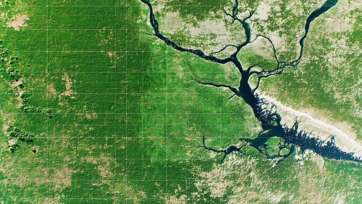
Change detection is not a new problem. Comparing two images of the same location taken at different times to identify what changed is one of the foundational tasks in Earth observation, predating digital imagery — analysts at aerial photography interpretation centers were doing it manually decades before satellite remote sensing existed. What has changed is the temporal resolution at which it's possible, and where in the data pipeline the detection step can occur.
Traditional EO change detection runs on the ground, comparing a new acquisition against an archived baseline, with latency measured in hours to days from collection to result. Running change detection on orbit, executing at sensor rate during the imaging pass, produces results before the satellite has even completed its pass over the target area. These are not incremental improvements on the same capability. They are fundamentally different capabilities with different use cases and different mission architectures.
The Signal Processing Challenge
Change detection in EO imagery is complicated by factors that are not present in controlled imaging environments. Illumination conditions vary between acquisition dates — solar angle, atmospheric haze, cloud shadow geometry all change. Sensor calibration drift produces radiometric differences between passes that can be misinterpreted as surface change. Seasonal phenological variation causes vegetation reflectance to change dramatically between summer and winter acquisitions, producing false-positive change signals in areas where the surface itself hasn't changed.
Ground-based change detection pipelines deal with these confounders through preprocessing: atmospheric correction, bidirectional reflectance distribution function (BRDF) normalization, radiometric cross-calibration between acquisition dates. These steps are computationally manageable on the ground and data-intensive — they require access to the full image and often to auxiliary data like atmospheric profiles and digital elevation models.
On-orbit change detection cannot run the same preprocessing pipeline. The compute and memory requirements for full atmospheric correction at sensor rate are not compatible with orbital hardware constraints. This is not a reason to conclude that on-orbit change detection doesn't work; it's a reason to design the on-orbit algorithm differently. Rather than attempting to produce atmospherically corrected surface reflectance and then compare, orbit-native change detection algorithms are designed to be robust to the radiometric variation sources that can't be corrected on orbit — using relative change metrics, local contrast normalization, and model designs trained on unprocessed or minimally preprocessed imagery.
Algorithm Design for the Orbital Environment
The most effective on-orbit change detection architectures are shallow by design. Deep convolutional networks with many layers may produce higher accuracy on benchmark datasets with access to ground processing, but they carry weight memory and inference latency costs that are prohibitive on orbital hardware with tight SWaP budgets. Shallow networks — or non-neural approaches adapted for hardware acceleration — that are explicitly designed for on-orbit deployment can achieve detection performance adequate for triage applications within the compute envelope that orbital hardware can support.
Change vector analysis (CVA) and its derivatives are computationally efficient and well-suited to FPGA acceleration, which is relevant for orbital compute platforms that use reconfigurable logic for inference tasks. Principal component analysis-based change detection approaches similarly map well to the linear algebra operations that can be efficiently accelerated on constrained hardware. The accuracy-versus-efficiency tradeoff for these approaches versus learned methods depends heavily on the specific change types being detected and the imagery characteristics of the mission.
For detecting relatively high-contrast changes — large-scale construction, significant vegetation clearing, major changes in facility footprint — simpler algorithms perform surprisingly well and are far more efficient. For detecting subtle changes — soil moisture shifts, minor vegetation stress, gradual erosion — learned methods with access to multi-date temporal context generally outperform simpler approaches. The implication for orbit-native change detection is that different application contexts warrant different algorithmic approaches, and the same hardware may run different detection pipelines depending on what the operator is monitoring.
Baseline Management
Change detection requires a baseline to change against. On the ground, baselines are maintained in large image archives with flexible temporal reach — an analyst can compare today's acquisition against an archive image from any previous date. On orbit, the baseline is constrained by what can be stored on the satellite and how it's maintained.
The practical options for on-orbit baseline management are limited but workable. A compressed baseline image or feature map for a set of target sites can be stored in non-volatile memory and updated periodically through uplinked data. For a mission monitoring a finite set of specific point targets, the total baseline storage requirement may be modest — a compact feature representation of each target site requires far less storage than a full-resolution baseline image. The tradeoff is that the on-orbit baseline represents a static snapshot from whenever it was last updated, not a continuously updated temporal stack.
We're not saying on-orbit baseline management provides equivalent flexibility to a ground-side archive. It clearly doesn't. But for missions where the change detection task is defined and the target sites are known, the limited flexibility is acceptable — the operator knows what they're monitoring and can design a baseline management strategy that fits the available storage and uplink constraints.
From Detection to Alert: The Output Pipeline
An on-orbit change detection result needs to be actionable. Raw pixel-level change masks, even if produced correctly, require interpretation before they're useful to a mission analyst. The output pipeline from an on-orbit change detector should produce structured results: georeferenced bounding regions of detected change, a confidence score, a magnitude estimate if the algorithm supports it, and a timestamp of the acquisition. This structured output can be produced at framing rate — once per image frame or at coarser spatial sampling — and is compact enough to be transmitted early in a contact window.
Consider a constellation operator monitoring approximately 200 infrastructure sites across a region of interest. Each site has a known location and a baseline image stored on each satellite. As the constellation passes over the region, onboard change detection runs against each site as it enters the sensor's field of view. Detection results for all 200 sites — flags, confidence scores, bounding regions — are packaged as a structured telemetry product and transmitted in the first two minutes of the next contact window. The full imagery follows in subsequent contacts according to a priority queue that reflects the detection results.
This pipeline changes the analyst's workflow from "here is a batch of imagery from the last 12 hours, find the changes" to "here is a pre-screened priority list of detections from the last orbit, confirm and take action." The analyst's attention is directed toward the sites that the onboard system flagged as changed, with full imagery available for confirmation. False positives require analyst review; false negatives are addressed by the periodic full-image archival pipeline.
Validation Before Flight
On-orbit change detection cannot be operationally validated after launch in the same way as ground processing pipelines. A ground pipeline can be updated, retrained, and redeployed when its accuracy is found to be insufficient. An on-orbit pipeline is more difficult to change — model updates via uplink are possible but require the bandwidth, the operational time, and the verification discipline to do safely.
The validation standard before flight should be treated accordingly. Representative imagery from the target region, spanning the seasonal variation and illumination conditions the satellite will encounter on orbit, should be used to characterize detection performance — true positive rate, false positive rate, behavior under cloud shadow and haze, behavior under seasonal change confounders. The model should be validated at the quantization precision and with the preprocessing pipeline it will actually use on orbit, not at full precision with ground-side preprocessing.
Getting this validation right before launch is the work that determines whether on-orbit change detection is operationally useful or merely theoretically interesting. The missions that treat onboard inference as a solved problem and skip rigorous pre-flight validation are the ones that discover post-launch that their detection pipeline is producing false positives at a rate that degrades operator trust. The change detection capability that consistently works within its stated accuracy bounds is the one that becomes a load-bearing part of the mission — not an experiment.